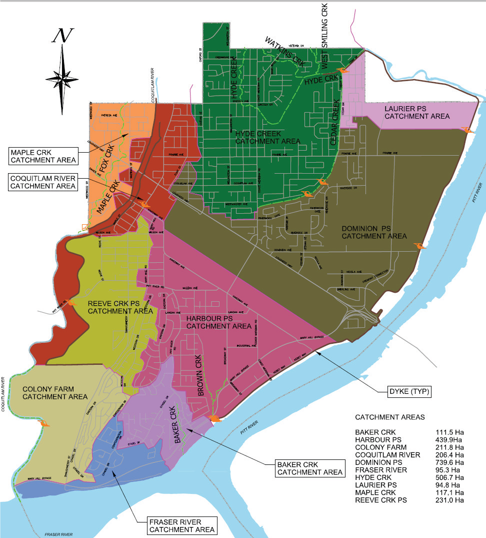
A watershed is defined as an area of land where all of the water drains to the same place. Municipalities manage stormwater within watershed boundaries to ensure that properties are protected from flooding and impacts to the environment are minimized. As a commitment to the Minister of Environment through the Liquid Waste Management Plan, municipalities in Metro Vancouver are required to complete Integrated Watershed Management Plans for all developed areas.
Integrated Watershed Management Plans (IWMPs)
Integrated Watershed Management Plans (IWMPs) are developed to preserve watershed health, while meeting community needs and facilitating growth. An IWMP investigates issues related to the quality and quantity of stormwater runoff, flood protection, environmental protection of aquatic resources, wildlife and their habitats, land use, greenways, and recreation. The plans include objectives and recommendations to mitigate and adapt to the effects of climate change (heat island effect, increased rainfall, drought, sea level rise, flooding, storm surges, etc.).
IWMPs outline cost effective solutions (capital, operation and maintenance, subdivision and development requirements) complete with implementation and maintenance plans. The plans also provide recommendations for an ongoing monitoring program to measure the impact of the plan and implemented projects on watershed health over time. Each plan requires 1-2 years to complete and typically has four phases: reconnaissance, identification of key issues and opportunities, planning and implementation.
The following IWMPs are being completed for Port Coquitlam:
- Hyde Creek IWMP
- Maple Creek IWMP
- South IWMP (Harbour, Baker, Fraser)
- North IWMP (Dominion, Laurier)
- West IWMP (Reeve, Colony Farm, Coquitlam River)
Catchment areas are shown on the Watershed Catchment Map.

